Unlock the Power of
Map Projects
Create, organize, and visualize complex geographical data with our advanced project tools. Designed for researchers, surveyors, and data enthusiasts.
Everything you need to map effectively
Our projects suite gives you the control and flexibility to manage large datasets and visualize them with precision.
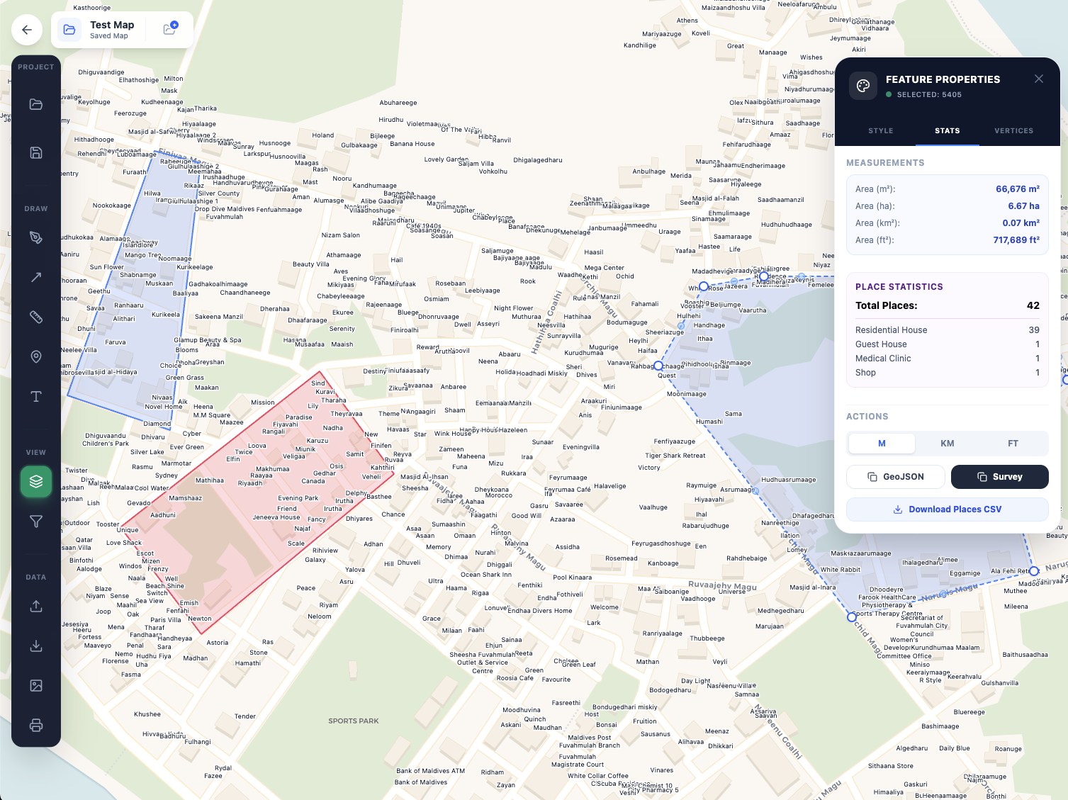
Advanced Map Editing
Draw precise polygons, lines, and markers. Edit boundaries with vertex-level control and annotate your findings directly on the map.
Layer Management
Toggle between different base maps (Satellite, Terrain, Dark Mode) and filter place types to focus on what matters most.
Data Persistence
Save your work automatically. Create multiple independent projects and switch between them seamlessly without losing context.
Collaboration Ready
Share your project snapshots with others (Coming Soon). Export your data for use in other GIS tools.
Secure & Private
Your research data is your own. We prioritize security and data privacy for all project information.
High Performance
Built on modern web technologies for smooth, lag-free interaction even with complex datasets.
Visualize data like never before.
From simple markers to complex polygonal geofencing, our editor handles it all. See the big picture with satellite imagery or drill down into the details with custom layers.
- Satellite & Terrain Views
- Custom Color Coding
- Real-time Auto-saving
Ready to get started?
Join the community of researchers contributing to the most detailed map of Fuvahmulah.